
Hawaii Topographic Map STL – 3D Terrain Model for 3D Printing & CNC
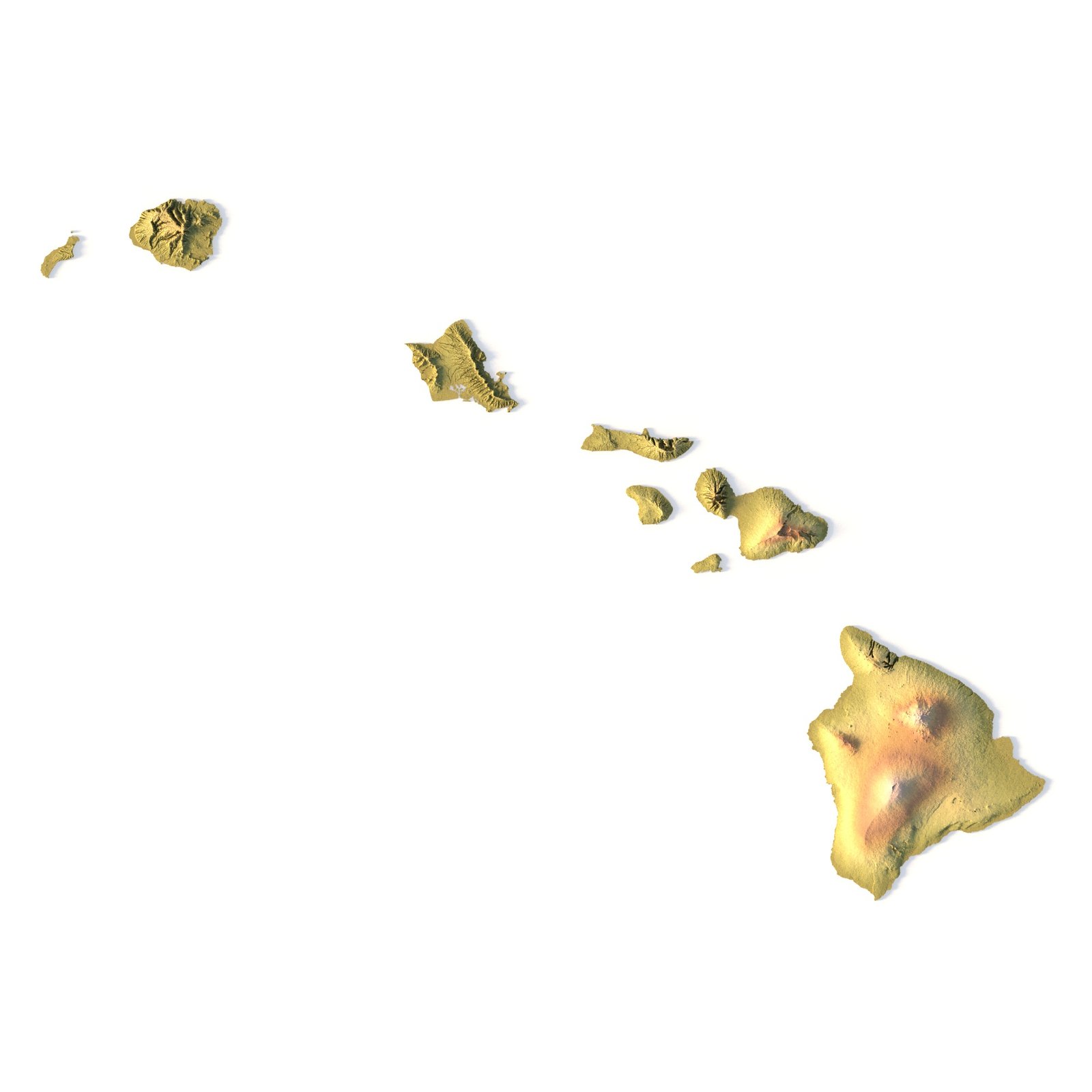
Order via WhatsAppHawaii Topographic Map STL – High-Resolution 3D Terrain ModelHawaii Topographic Map STL is a high-detail 3D terrain model generated from accurate elevation data and optimized for 3D printing, CNC carving, and laser engraving. The model precisely represents the dramatic volcanic landscapes of the Hawaiian Islands, including mountains, calderas, ridges, and coastal relief, making it ideal for professional, educational, and creative applications.This Hawaii terrain STL model is supplied in standard STL format and is fully compatible with FDM and SLA 3D printers, as well as CNC routers and milling machines. Enhanced vertical scaling ensures strong depth perception and clear terrain readability, allowing the unique topography of the islands to stand out in physical relief maps.Key Features of the Hawaii Terrain STL ModelHigh-detail Hawaii topographic map STLAccurate digital elevation model (DEM)Optimized for 3D printing (FDM / SLA)Ready for CNC carving and millingSuitable for laser engravingMercator projection for consistent geometryTriangle-only polygonal meshOpen or closed base configurationApplications of the Hawaii 3D Topographic MapThis Hawaii 3D terrain model supports a wide range of use cases:Raised topographic relief mapsCNC-carved wooden or metal terrain modelsEducational geography and geology projectsVolcanic and tectonic visualizationMuseum exhibits and presentation displaysDecorative wall maps and custom installationsWhether you are producing a 3D printed Hawaii map, a CNC terrain model, or a laser-engraved relief, this STL file delivers high visual impact and professional-grade accuracy. This product on Cults3D →FAQ Are the model’s proportions realistic? The description includes scaling factors for each axis. For example, if you see X – 0.001, Y – 0.001, Z – 0.003, this means the height is three times greater than the width and length. We scale height this way to emphasize the relief. If you need uniform proportions, let us know—we’ll prepare a custom model upon request. How can I adjust the model’s height? Send us your required specifications, and we’ll adapt the model accordingly. Is the model waterproof? Yes, we check every model for integrity and errors. Can it be printed on FDM printers? Yes. For better surface quality, we recommend printing it vertically. How to CNC-cut a very large map? Larger models require more polygons to preserve relief detail. Provide your desired dimensions, and we’ll prepare:A single optimized model orA segmented version with high resolution. Can I get the model in STEP format? Yes, but polygon reduction may be necessary. Submit a request with your project’s dimensions for a tailored solution. If you have any other questions or special requests, feel free to get in touch with us. We’re here to help!Hawaii Terrain 3D modelHawaii 3D terrain without water